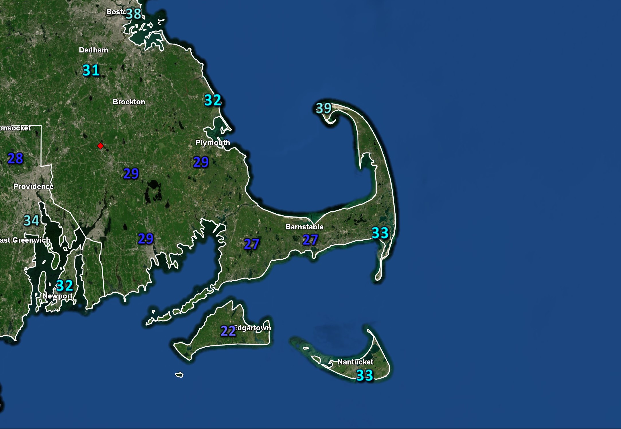
What to look for today on CapeCodWeather.Net:
- Your Cape Cod Weather Forecast is available HERE.
- Wind Advisory Posted for Monday Night.
- Gale Warnings posted for the Coastal Waters
- Track the precipitation on the Local Radar.
- Brunt of the storm stays to our south.
- A Homemade Solar Heater...Made from Beer Cans?
- Find the Galaxy M81 with binoculars! - Whats Up for May.
- On Facebook? Join the official CapeCodWeather.Net group!
In the last few months CapeCodWeather.Net...
- has attracted visitors from all 50 States.
- has had users visit the site from six continents (no internet in Antarctica?)
- has attracted visitors from over 70 countries
- has had 100s of visitors from the UK and Ireland
Reach this audience by getting your information on this site.
Daily Weather Summary
Across the Country: An unusually strong storm system for this time of year is currently spinning over the Mid-Atlantic, bringing moderate to heavy rain along with gusty winds to parts of the Mid-Atlantic region. The low will move out into the Atlantic Monday, slowly dragging the rain with it. Strong winds along the Mid-Atlantic coast up into New England will continue. The strong winds should begin to subside across most areas by Tuesday night. Cooler and drier air will move in across the Southeast as high pressure builds in. Across the West, a cold front extends through central Wyoming into central Nevada. The front is forecast to continue moving south and east, reaching the Midwest and Southern Plains on Tuesday. This system is bringing scattered rain and snow to the Rockies and Great Basin. - courtesy NOAA Watch

